
Not every line on a map is a border, but sometimes it tells us something about one anyway. Israel's new wine map has just been approved, and it's already stirring up a political storm. On the surface, that sounds like cause for celebration: the State of Israel finally knows where its wine grapes grow. The map includes eight super-regions, sub-regions, names, boundaries, soils, elevations and climates. But look closely and a different story emerges: a professional committee that made no attempt to blur the geography, and instead chose to call every region by its name. Before popping the champagne, it's worth opening the map first, and then checking whether the state can actually verify that what's written on the label is really what's in the bottle.
They Checked the Soil, and Got a Border
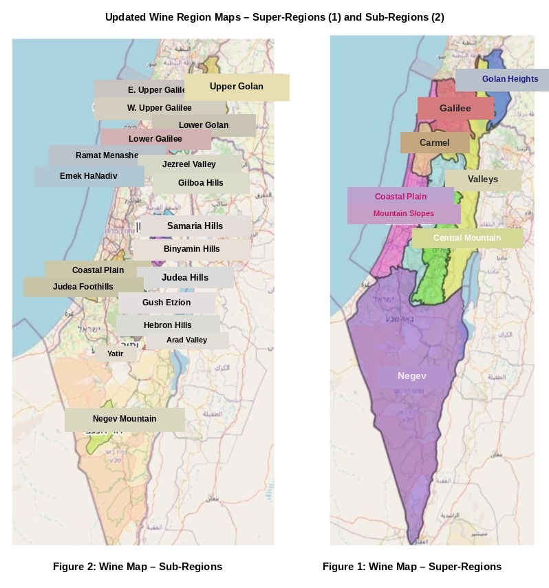
Look at the map for what it actually is, not just through terroir-tinted glasses, and you discover that the State of Israel didn't just approve a wine map. It drew a geographic document that tells a much bigger story. It includes the Galilee, Carmel, the valleys, the coastal plain and the Negev, but it also includes the Golan, the Samaria hills, the Binyamin hills, the Hebron hills and Gush Etzion. And the moment names like these enter a government map, wine stops being just wine, and the line on the map starts to talk.
So the real question is what exactly got approved here: a soil map, a marketing tool for wineries, a terroir map, or a political statement wrapped in vine leaves? And maybe, contrary to what some of its opponents claim, this map actually does something no one intended: it marks, very clearly, exactly where one region ends and another begins.
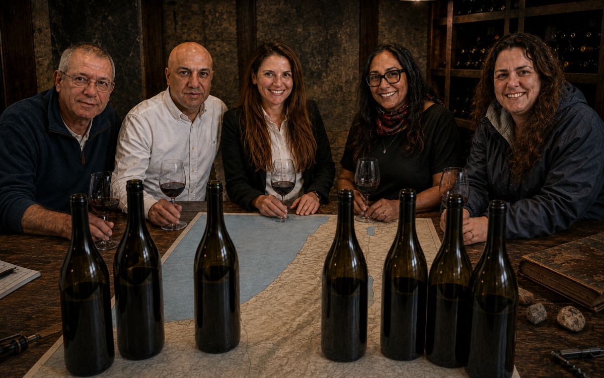
Before getting to the politics, credit is due for the professional work. The committee wasn't made up of PR people, lobbyists, or self-appointed terroir experts, but of people who actually know the ground: Noa Moaz, an agronomist at Israel's Grape and Wine Board, trusted even by the people at the Israeli Professional Organization for Wine Production and Growing (IPEVO) to protect their interests, though they themselves never bothered to ask for a seat on the committee, not even as observers; Omer Ben Asher, head of GIS (geographic information systems) at the Ministry of Agriculture and Food Security; Alon Maor, director of the conservation and sustainable agriculture division; Shimon Fragman, a vine-growing instructor and referent; Dr. Noga Naor, head of food risk management at the Ministry of Health; Marc Perl, head of agro-meteorology; and Prof. Shivi Drori, head of the Institute for Grapevine and Wine Research at Ariel University.
All of them examined climate, soil, topography, elevation, geographic continuity, history and growing tradition, scale of agricultural activity, oversight and traceability. You can argue with the result, but it's hard to claim the lines were drawn over lunch with a glass of chardonnay in hand, or in a Knesset faction meeting.
Who Guarded the Map from Vested Interests
After almost seven years of discussions, arguments, maps and reservations, someone still had to take all that material and turn it into a decision. Penina Oren-Shnidor, director of consumer product (food and cosmetics) regulation at the Ministry of Health, did exactly that. She set up the professional committee and led its work through to the final map. To her credit, she didn't settle for what people already knew in the corridors of her own ministry (they still don't know much), but consulted with wine-industry professionals, including Tzachi Dotan, director-general of Israel's Grape and Wine Board, and senior officials at the Ministry of Agriculture and Food Security: Natalie Mor, deputy director-general, and Oren Lavie, director-general, who stood firm guard to keep politics, and the attempts of certain wineries to influence the map's boundaries, out of the room.
Another committee member worth pausing on is Prof. Shivi Drori, who, besides heading the Institute for Grapevine and Wine Research at Ariel University, is also a winemaker and partner at Gvaot Winery, located and operating beyond the Green Line. In his case specifically, I'm not looking for a conflict of interest and I'm not raising an eyebrow. On the contrary: Drori is a pragmatic professional who knows the world of grapes and wine, and the complex reality of the region he himself operates in, intimately. So a person who knows firsthand the wineries beyond the Green Line took part in shaping a map that doesn't erase the differences and doesn't blur them. This is exactly the test of a professional committee: not whether the result is comfortable for everyone, but whether it's willing to draw what the data actually shows.
I Looked for Annexation, Found a Border
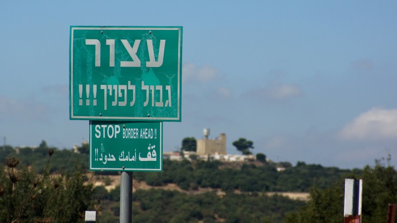
Precisely because this was professional work, the questions about it are harder. A map can start with soil and end with sovereignty. It can help a winery sell wine in Paris, and in the same breath give someone who doesn't want to buy Israeli wine one more reason to leave it on the shelf. It can be an excellent terroir map and, at the same time, an explosive political document. After going over the map again and again and speaking with dozens of winemakers across the country, I reached a conclusion nearly the opposite of some of its opponents, who see it as an attempt to annex the territories occupied in 1967. My colleague, wine journalist Sagi Kupper, even called it "the official wine map of the Palestinian Authority in Israel." I read it the exact opposite way. The map doesn't swallow Judea and Samaria into Israel; it gives every region its own address and refuses to pretend it's all the same place. Where Kupper saw the Palestinian Authority entering Israel's map, I saw the State of Israel marking, with its own hand, where Israel ends and something else begins. Not annexation, but division, with an official government stamp on it.
I went looking for the annexation the critics warn about. I looked for the attempt to erase the line, to blend everything into one big "Israel" and paint the Galilee and Judea and Samaria the same political color, and what I found was almost the opposite: the truth, the whole truth, and nothing but the truth.
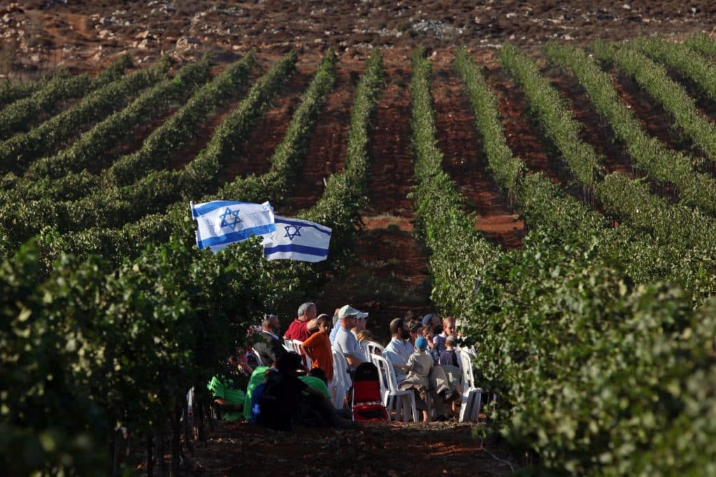
The map doesn't erase the Samaria hills, it writes "Samaria Hills" explicitly. It doesn't hide the Binyamin hills inside the Judea hills, it gives them their own name. The same goes for Gush Etzion, which is Gush Etzion, and the Hebron hills, which are the Hebron hills. You can argue about whether they belong in a wine map approved by the State of Israel at all, but it's hard to claim the map is hiding them. It does exactly the opposite: it puts them on the map.
And here I am, someone who believes in two states for two peoples, finding myself smiling at a government wine map. You call it an annexation map, and I look at it and see a map that marks exactly what Israeli politics has spent decades trying to blur: there is Israel, and there is Judea and Samaria. There are wineries here and there are wineries there. You can love that, you can hate it, you can buy from both, you can boycott one of them, but at least now you can know what we're actually talking about.
This is exactly where part of the criticism of the map starts tripping over itself. On one hand, people argue that including the Samaria hills, the Binyamin hills, the Hebron hills and Gush Etzion on the map blurs the difference between Israel and the territories. On the other hand, they warn that the same map will let the world identify wines coming from those same areas and boycott them.
Sorry, but you can't hold both claims in the same hand. If the map lets you identify where a wine comes from, it isn't hiding the geography, it's exposing it. And I actually want the consumer to know. Want to buy wine from the Binyamin hills? Buy it. Want to boycott it? Don't. Want wine from the Galilee, the Carmel or the Negev? Go ahead. I don't need the state deciding for me which wine I'm allowed to love, and I certainly don't need a wine map to solve the Israeli-Palestinian conflict for me. What I need from it is something much simpler: to tell the truth about the place.
A wine map isn't a peace agreement, an agronomist isn't a UN envoy, and a soil profile won't determine an international border. But that's exactly what makes the result so interesting. The professionals looked at soil, climate, elevation and geography, and ended up with a map that stops pretending everything is the same thing.
Two States for Two Peoples? Not Yet. But Two Geographies on the Wine Map, Already Yes
Sometimes it takes a wine map to see what we've been arguing about since 1967. Maybe after almost sixty years of debate, the vine managed to do what we struggle to do ourselves: not resolve the conflict, but at least mark where it is.
Now Look What Happened to the Wineries Themselves
Up to now we've talked about borders as if they were just lines on paper. But those lines have addresses, vineyards, brands and wineries attached to them. The new map didn't just divide the country into wine regions; it took wineries that had spent years telling one particular geographic story and placed them inside a different one.
Take Domaine Winery, for example. For years it was identified with the Yatir region, but open the new map and you'll find it in the Hebron Hills region instead. The winery didn't move, the vineyards didn't move, the soil didn't change. Only the line moved, and in one stroke of a pencil, its wine address changed. Gush Etzion, too, which had built itself a clear wine identity, was separated from the Judea hills and given its own definition inside the "Central Mountain" super-region. Professionally, you can argue whether that's the right division. Politically, it's hard to ignore what just happened here.

And if you think this whole story was born only out of Judea and Samaria, head north. The Golan Heights is now its own wine region, split into Upper Golan and Lower Golan. The old habit of filing Golan wines under the broad, convenient umbrella of "Galilee" no longer fits the new map. Golan Heights Winery is in the Golan, its grapes grow in the Golan, and the map, in an almost annoying simplicity, calls the place by its name.
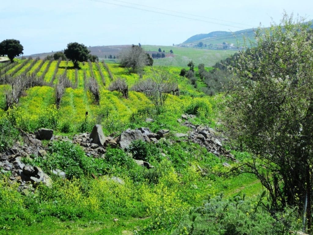
This is a bigger change than it looks. For years the word "Galilee" wasn't just a geographic definition, it was also a marketing asset, and when it came to exports, that label sometimes let a wine be presented under a regional name that didn't carry the political weight of "Golan Heights." Now, at least according to the new professional map, the Golan and the Galilee are no longer the same address.
So it's getting harder to argue the map was built purely to annex or to blur. If that had been the goal, the easy path would have been to leave the Golan inside the Galilee, Gush Etzion inside the Judea hills, and Domaine inside Yatir. Instead, the map does something far less convenient: it separates. It stops letting everyone huddle under broad, comfortable geographic names, and starts calling places by their names.
Now comes a more interesting test than any speech about annexation: are the wineries themselves willing to live with the map they asked for? It's easy to demand a professional wine map as long as the line runs where it's convenient for you. It's much more interesting to see what happens when agronomy, topography and geography separate you from the identity you built for yourself over the years. A professional map isn't supposed to ask a winery which address is more convenient for it commercially. It's supposed to tell it where it actually is, and now some wineries may discover that the map knows exactly where they are, even if the answer is less convenient than the address they'd gotten used to.
Now You Can Relax, Because No One Is Forcing You
After talking about borders, annexation, two states, the Golan, Gush Etzion and the Hebron hills, it's time to bring the anxiety level down a notch. The new map is voluntary, and no winery is required to use the region names it sets out. You can write "Israeli wine" on the label, note a super-region or a sub-region, or not mention a region at all. In simple terms, the state isn't forcing any winery to tell the consumer its geographic story. It's just giving it the option to do so.
But, and this is a very big but, the moment you decide to use a geographic name, the creativity stops. The name has to match the approved map, and you can't invent a region that sounds better, hide behind a broader and more convenient name, or pick a different address just because the one the map gave you doesn't suit your taste.
Want to skip the map? Write "Israeli wine" and move on. Want to use the map? Great, then use the map. This might be the fairest part of the whole move: the state isn't forcing any winery into the regional game, but whoever chooses to play accepts all the rules that come with it. The map is voluntary in the sense of whether to use it, not in the sense of what it actually says.

Nice That You Drew a Map. Now Who's Guarding It?
So far, everything is wonderful. There's a map, there are borders, there are regions and sub-regions, and there's even freedom of choice. Except now comes the part where a pretty map has to meet Israeli reality, and that's where I get a lot less relaxed.
On paper, two excellent words appear: "oversight and traceability." Words I like a lot. Now I just want to know who's actually standing behind them. When a winery writes "Judea Hills," who checks that the grapes really came from the Judea hills? If a winery writes "Eastern Upper Galilee," what percentage of the grapes in the bottle need to actually come from there — 100 percent, 85 percent, 51 percent? And what happens if the Cabernet Sauvignon came from the Galilee, the Merlot from the valleys, and the Petite Sirah from the Hebron hills altogether — who decides which address the kid gets?
This isn't a theoretical question, because grapes in Israel travel, a lot. Wineries buy grapes from different regions, supplement varietals when needed, swap sources between harvests, and produce blends that don't always respect the borders we so love drawing on maps. That's completely legitimate. But from the moment you chose to put a region's name on the bottle, I, as a consumer, want to know that name actually means something. Otherwise, all the discussion of soil, climate, elevation, terroir and regional identity becomes a bit of empty talk. If there's no mechanism linking the vineyard, the delivery note, the winery and the bottle, we haven't built wine regions, we've built pretty names for labels.
This is exactly where the committee's work ends and the regulator's responsibility begins. The state tells the winery: you don't have to state a region on the label, but if you choose to, you have to use a name approved on the map. Fine. Now comes the less festive part: making sure the grapes the wine in the bottle was made from actually came from the region named on it. Otherwise, the winery got an address, but nobody's checking whether it actually lives there.
It Wasn't the Left Who Drew This Map, But the Sovereign Itself
I have to dwell on the great irony of this whole story. It is precisely under a right-wing government, some of whose members speak openly about applying sovereignty and firmly oppose the idea of two states, that the Ministry of Health and the Ministry of Agriculture and Food Security approved an official wine map and started drawing lines. Not the UN. Not the European Union. Not Yair Golan, and not some official in Brussels. It was the State of Israel itself.
One can say, rightly, that this is an agricultural division, not a political one, that it concerns growing regions rather than international borders, and that not a single grape determines sovereignty. All of that is true. But maps are dangerous creatures. The moment the sovereign draws a line, gives each side a name and approves it in an official document, you can't expect everyone to see only acidity, elevation and chalky soil in it.
I'm not claiming the Ministry of Health and the Ministry of Agriculture signed a new Oslo Accord here. They didn't. They approved a map of growing regions. But I do suggest that everyone rushing to shout "annexation map" take another look at who drew it, and what they actually drew. Because in the end, it turns out that when politicians can't agree on where the border runs, you can always call in an agronomist, or in our case, an agronomist who happens to be a woman.
After All the Politics, We Almost Forgot: Maybe It's Simply a Very Good Wine Map
After all the baggage we managed to load onto a single bottle, it's time to do something almost revolutionary: talk about the wine. Set the politics aside for a moment and look at the map through the vineyard, and it's hard to ignore that serious professional work went into it. The Golan isn't a single block, so it's split into Upper Golan and Lower Golan. The Galilee isn't just one big blob in the north anymore, but Western Upper Galilee, Eastern Upper Galilee and Lower Galilee. The Carmel includes Ramat Menashe and Emek HaNadiv, and in the south you'll find Yatir Forest, Arad Valley and Mount Negev.
These aren't just pretty names for a label. Behind them stand real differences in elevation, temperature, soil, topography, climate patterns, geographic continuity and agricultural history. Someone is finally saying out loud what anyone who's spent enough years wandering Israeli vineyards already knows: not all of the north is "Galilee," not all of the south is "Negev," and not every vineyard an hour's drive from another grows the same grapes under the same conditions.
That's exactly what a good wine map is supposed to do. Not promise the wine will be good, not hand out grades to wineries, and not decide which Cabernet Sauvignon is worth 200 shekels. It has to give a place a name, and give that name meaning. You can argue over this or that line, ask whether a particular region should have been split differently, and keep arguing about the names for years to come. But for the first time, Israel's wine industry has an organized geographic language it can start working with seriously.
After everything I've written, I'm ready to say this without cynicism. In an interview with Penina Oren-Shnidor, I asked her a simple question: "Is this good for the Jews?" Now I can answer: yes. In my opinion, this map is good. Maybe even very good. It won't resolve the Israeli-Palestinian conflict, won't set international borders, and certainly won't make peace. That's not its job. But it does look at the land, gives places names, and isn't afraid to show that they're different from one another.
One thing can already be said: after years of talk, this map exists. For better or worse, depending on which side of the political divide you stand on, this is a move people will still be talking about for years. And sometimes good governance is simply the ability to stop talking, take responsibility, and decide.
Maybe, just before the elections, it's worth remembering that too. While professional civil servants can still sit around a table, argue, listen, check the data and ultimately make a decision, our politics has turned almost everything it touches into a battlefield. Agriculture, culture, law, media, and now even wine. Instead of nurturing, they tear apart. Instead of connecting, they mark enemies. Instead of preserving the good and pure things we still have left, they profane those too for the sake of one more political round.
I won't hide behind polite phrasing: in my view, much of the responsibility for that lies with the political breed currently in power. A breed I wouldn't plant in a vineyard, and certainly wouldn't bottle. Lucky for us, this time at least, the wine map was left to the professionals. And anyone who wants to see it as an annexation map should look again. I looked, and I saw a wine map. I saw borders. I even saw, in it, two states for two peoples. Who would have believed all of that could fit into a 750 ml bottle.
Comments
0